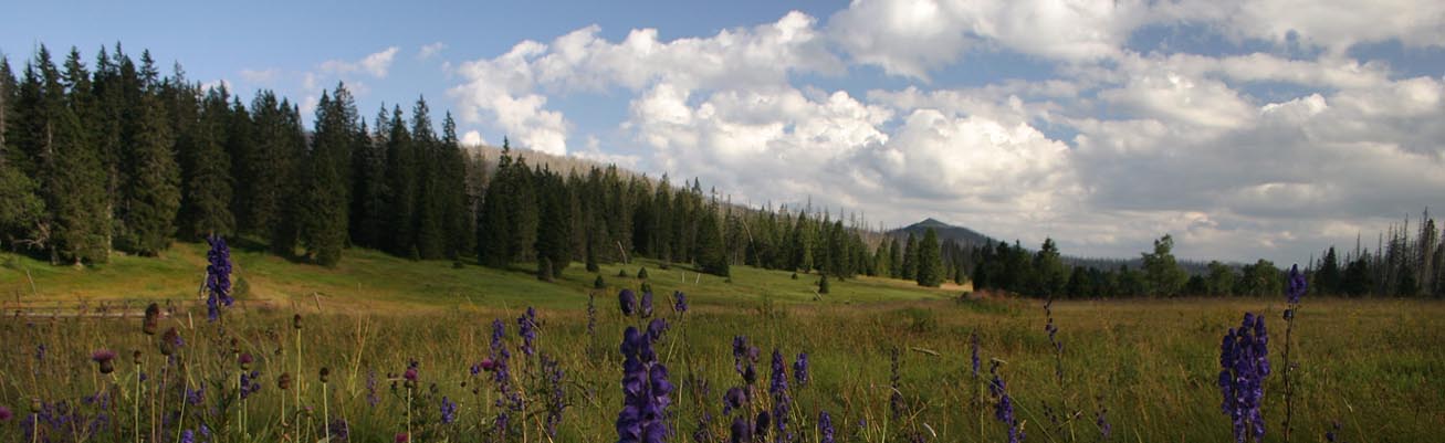
Forests
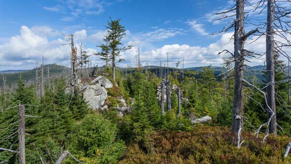
The forests are the largest and very important ecosystems of the Bohemian Forest. The highest parts of the mountain range are covered by mountain spruce forests. Natural disturbances, windstorms together with spruce bark beetles, often cause serious diebacks in mountain spruce forests. Deep knowledge of ecosystem ecology is necessary for appropriate management of these areas. An increasing numbers of mountain spruce forests growing in nature reserves and core zones of national parks are managed as “non-intervention areas” and nature disturbances are accepted as integrated part of their development. Sufficient natural regeneration is a key factor of natural reconstruction of these forests.
Both national parks – Bavarian Forest NP (1970) and Šumava NP (1991) protect together 22.670 ha of mountain spruce forests, one of the largest complexes in Central Europe. A large-scale and long-term investigation of mountain forest natural regeneration has been started in non-intervention (“natural”) zone of the Bavarian Forest NP in 1991 (HEURICH et al. 2010). Already the sixth repeated investigation has reported a rich natural regeneration with high genetic diversity and high spatial variation. A successful recovery of mountain forests in Bavarian Forest NP after windstorm and bark beetle outbreaks has been confirmed. In the Šumava NP the inventory of mountain forests regeneration has been started in 2008.
Monitoring project design
The BIOKLIM project (Biodiversity and Climate Change, BASSLER et al. 2015) is the first project covering a whole non-intervention zone. The BIOKLIM Monitoring is a large biodiversity survey and aim to provide a broad range of data to assess the effects of the benign neglect strategy on species and communities across different taxonomic groups. A further aim is to assess and predict the consequences of climate change on the low mountain range. First inventory started in 2006 in the Bavarian Forest NP. This survey will be repeated in 2016 and extended to the Sumava NP. The common monitoring of biodiversity will be implemented using the consistent methods. This ensures to provide comparable data for the bilateral national parks sharing the same ecosystems.
Location: 147 study sites covering the whole elevational gradient in Bavarian Forest NP; ca. 150 study sites in the Sumava NP. Map
Methodology: On each plot a plethora of environmental variables is measured, recorded or modelled. It includes for example basic topographic information (e.g., altitude, exposition), forest structural variables (e.g. dead wood, tree species composition at different strata), soil chemical physical and chemical properties, and a set of biological meaningful climate variables. Data on 25 higher taxonomic groups (mainly plants and insects) were collected (for details see BÄSSLER et al. 2008).
Main outputs: Regional data from a large biodiversity survey can be used in various ways: 1. Supporting decisions of the National Park management, 2. Improving our knowledge on how species and communities respond to a benign neglect strategy in a former commercial forest within a highly cultivated landscape in Central Europe, 3. Allowing to make concrete recommendations in order to improve biodiversity needs in commercial forests, 4. Providing evidence on the impacts of climate change on species distribution and allowing to make predictions on the extinction risk of species.
TheBiomonitoring project started in 2008 in Šumava NP and provided detailed information about the state and development of forests in non-intervention areas (ZENÁHLÍKOVÁ et al. 2015). Study sites of this project are situated in zones, where active forest management is applied. Some plots are used as study sites for the transboundary monitoring project focusing on biodiversity drivers in forests and influences by climate change.
Location: Permanent circle plots (500 m2) of the Biomonitoring project are irregularly distributed within the Šumava NP in the non-intervention zones and all Natura 2000 habitats protected in the SCI Šumava are investigated within the Biomonitoring project. Map
Methodology: Data on each plot are clustered in seven sections: (1) plot characteristics; (2) living trees (DBH>30 cm, or >7 cm); (3) dead trees; (4) snags and stumps; (5) lying dead wood; (6) tree regeneration; (7) phytocoenological relevé and proportion of microsites important for tree species regeneration. Also soil characteristics are recorded. Already more than 750 plots were measured. The methodology of the Biomonitoring project is also comparable with the monitoring of natural regeneration in the Bavarian Forest NP (HEURICH et al. 2010).
Main outputs: The Biomonitoring project provides detailed information about the state and development of forests in non-intervention areas of the Šumava NP. Data, continuously collected by the Šumava NP employees, are comparable with data from the project Operational Forest Inventory, another project operated by the Šumava NP Administration. Already the first results confirmed successful natural regeneration in disturbed spruce forests occurring in the Šumava NP (ČÍŽKOVÁ et al. 2011) and its importance will increase in the future, when we will have data from repeated investigations.
References: The Biomonitoring and BIOKLIM projects
