Mires
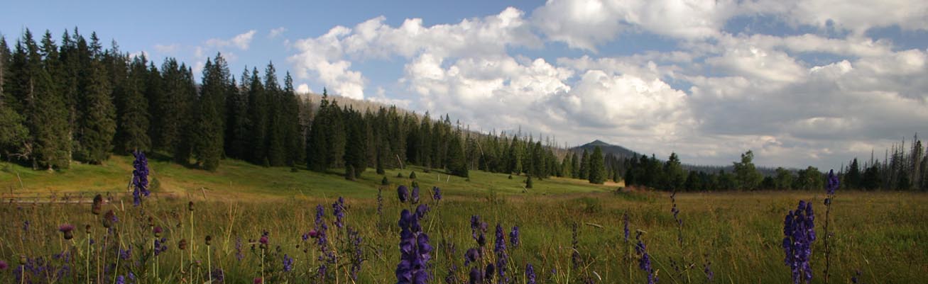
The peat bogs are the most valuable as well as most sensitive biotopes of the Bohemian Forest. Its mystery and old-time stories are indissolubly connected through this unique world on edge of dry land and water.
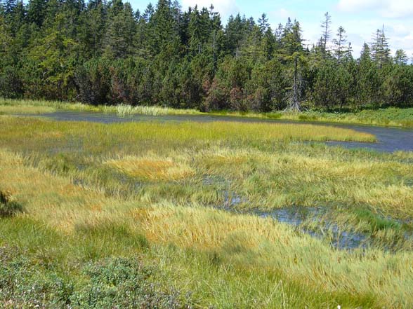
For the Bohemian Forest, as for the other Central European forested landscapes, peat lands or mires are relict ecosystems, being more typical for northern tundra and taiga. In the Bohemian Forest, the mire types range from the typical dome-shaped raised bogs that are fully dependent on the rainfall, to the forested or open fens fed mainly by the groundwater. Both types of bogs are often surrounded by waterlogged spruce forest or birch forest on peaty soils. They host rare orchids, such as lesser twayblade (Listera cordata) and coral-root orchid (Corallorhiza trifida). Non-forested sedge mires are usually smaller and can be either natural (located on springs) or secondary (developed as the results of deforestation and traditional land use). They are important for their high biodiversity (both plants and insects).
The largest Central European complex of peat bogs and marshlands covering over 10,000 ha has been designated as the Ramsar site since 1990.
About 70 % of mires in the Bohemian Forest have been influenced by past drainage for variously forestry, agriculture and peat extraction. Since 1999, a comprehensive "Mire Restoration Programme" has been implemented in the Šumava National Park, primarily focused on the disturbed hydrology.
Selected drained and intact mires are monitored with the aim: i) to characterise the degradation changes induced by the disturbed hydrology; and ii) to evaluate the success of restoration. Water-table fluctuations, hydrochemistry of groundwater, surface-water outflow, amount of precipitation and the vegetation on permanent plots have been monitored since 2005, some hydrological data since 1995. The monitoring design is will extended to several mires in the Bavarian Forest NP.
Monitoring project design
Location: In the Šumava NP the mire habitats and streams are located in the upland area ("Modravské slatě") mire complex, floodplain of the Upper Vltava river ("Vltavský luh"), basin of the Křemelná river Map
Methodology: 9 mire sites in Šumava NP and 6 sites in Bavarian Forest NP with different level of drainage (intact control, moderately disturbed and highly disturbed) are monitored. Both ombrotrophic mires - raised bogs - and minerotrophic mires - spruce mires, fens are represented. In total, 115 permanent plots with associated water wells are monitored. Monitoring provides data on microtopography, hydro-ecology condition and vegetation of the different mire sites. The following environmental variables are recorded:- water table position- runoff from restored sites- water chemistry of both groundwater and surface water- peat chemistry- precipitation- microclimate condition (air, soil moisture and temperature)- vegetation. Water table position are measured manually in all (115) boreholes in approximately two-week intervals from April to November. Automatic gauging (at 1 h intervals) by piezometers are used in a selected boreholes. Water samples from selected boreholes, ditches and runoff profiles from both drained and control sites are taken monthly for a detailed hydrochemical analysis, including the content of main cations and anions (SO4, NO3, NH4, PO4, Ca, Mg, K, Al, Fe, Cl, total P, total N), pH, conductivity and DOC. Runoff from drained sites as well as the amount of precipitation are measured continually using UV sensors in the standard Thompson profiles for runoff data. Vegetation are sampled in 1×1 m permanent plots (115) around each borehole.
Main outputs
Long-term data about monitoring both natural and renaturalised mires. Data are processing now.
References: Mires
